Greece responds to Turkish claims about islands with maps
The Greek Ministry of Foreign Affairs on Thursday responded to recent Turkish claims regarding the sovereignty of the Aegean islands with the publication of 16 maps, demonstrating “in a vivid and irrefutable way the Turkish illegal unilateral actions and claims.”
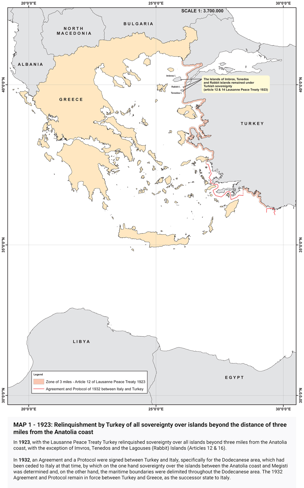
The maps begin chronologically with the status quo enshrined in the Lausanne (1923) and Paris (1947) treaties.
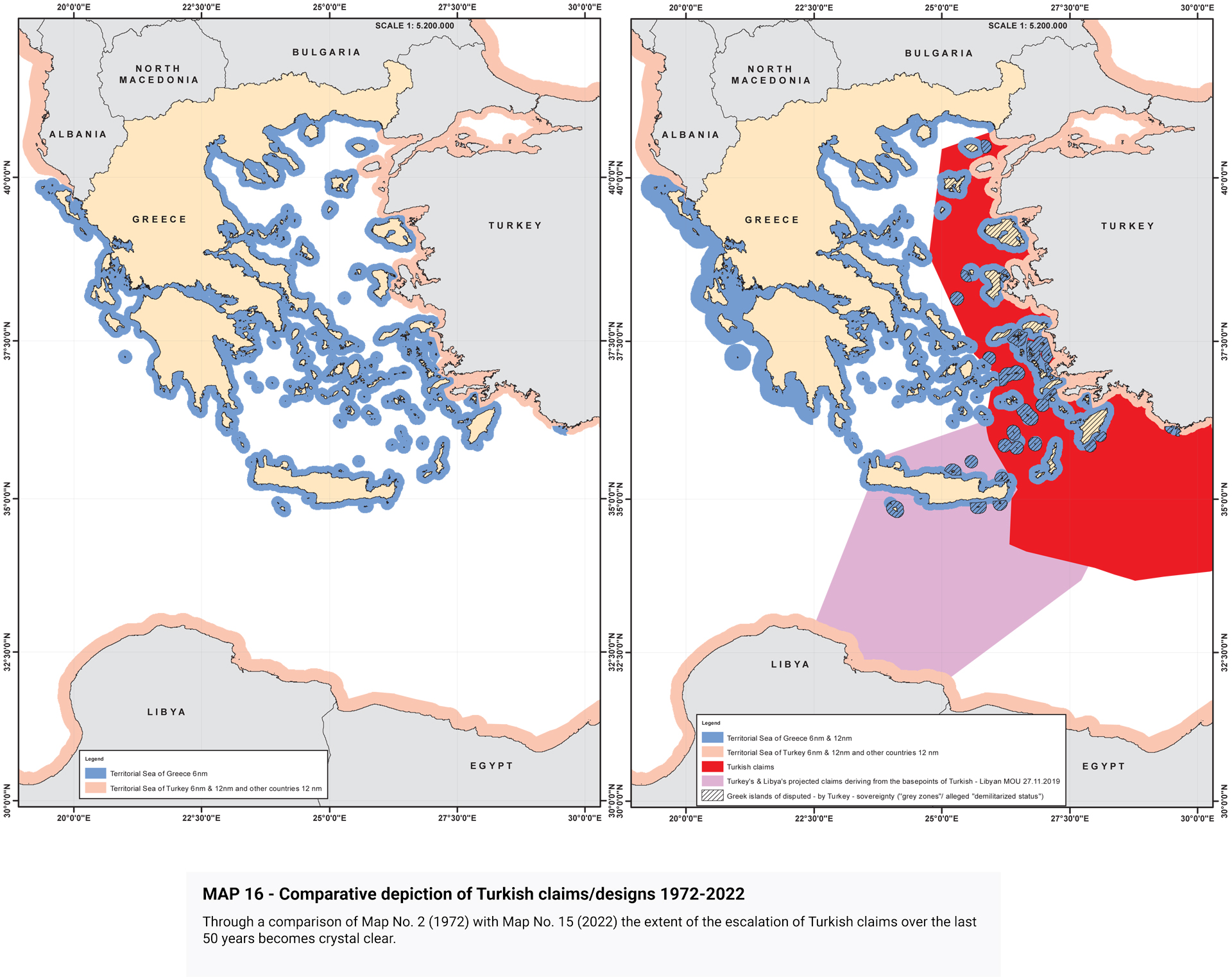
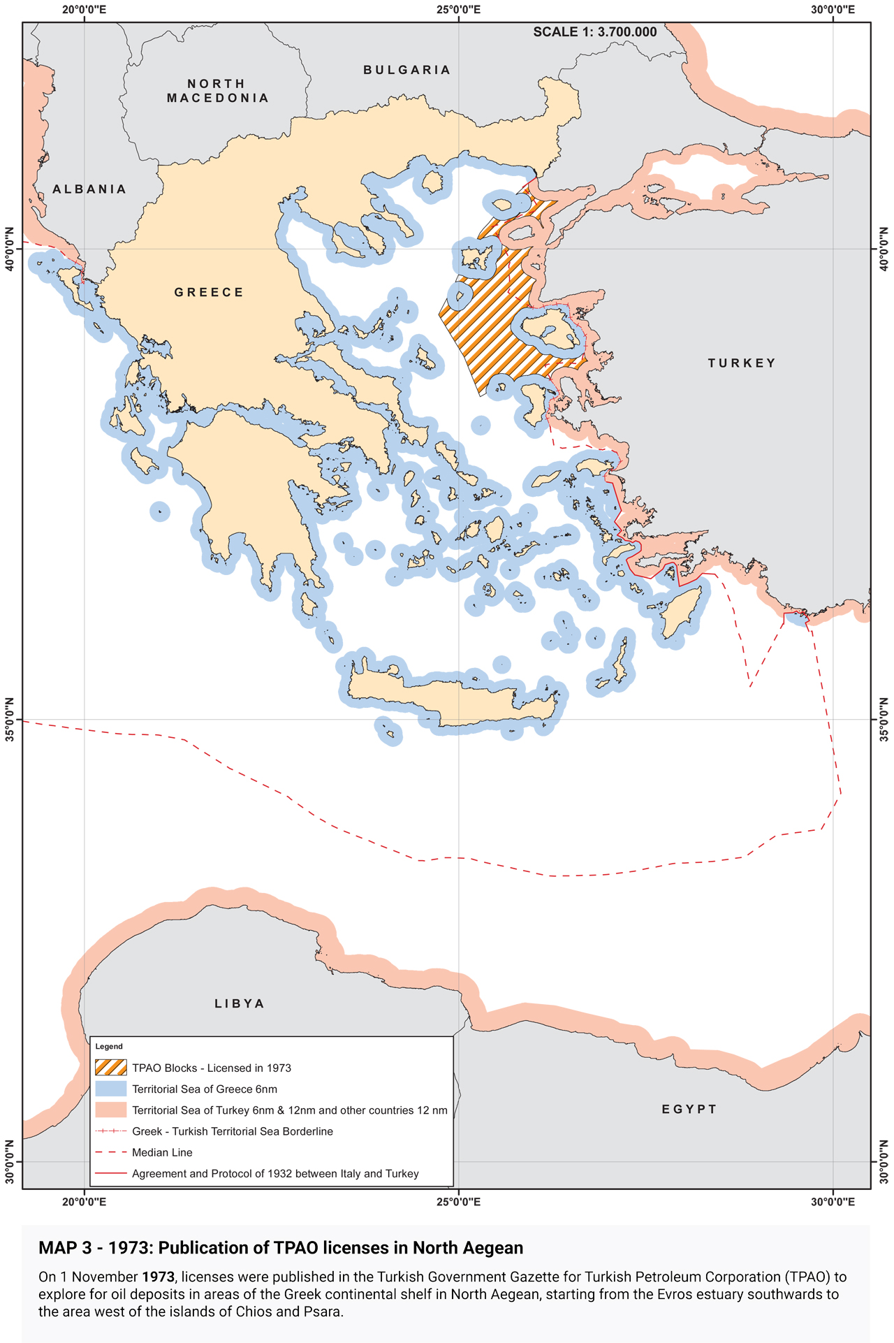
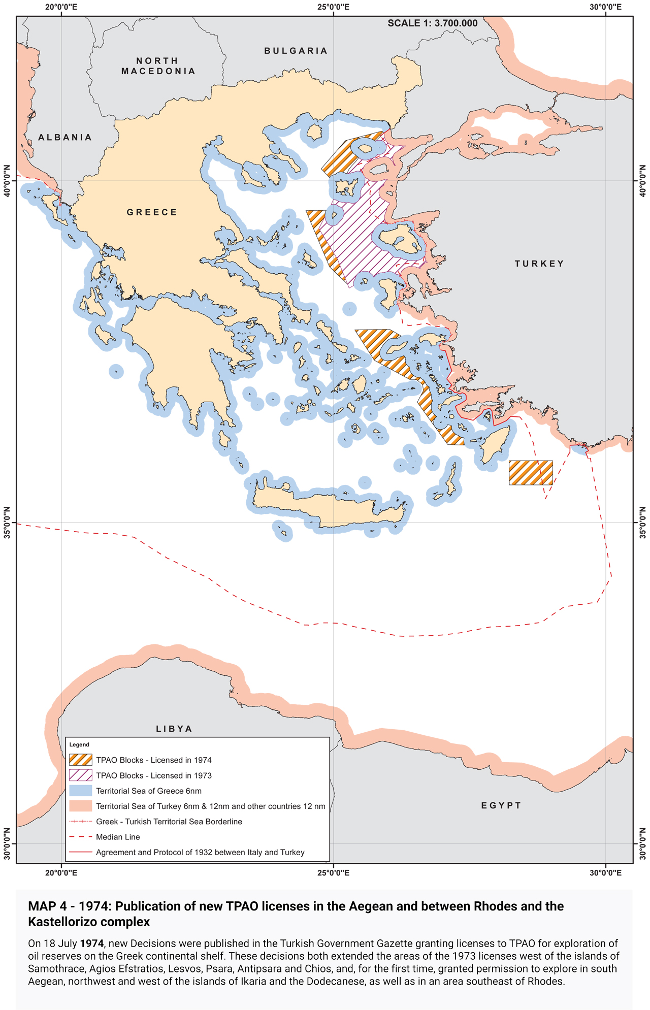
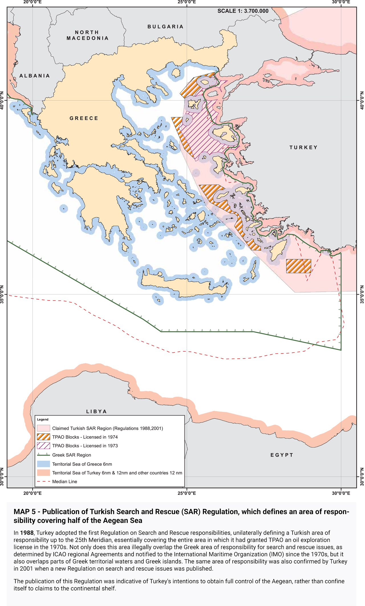
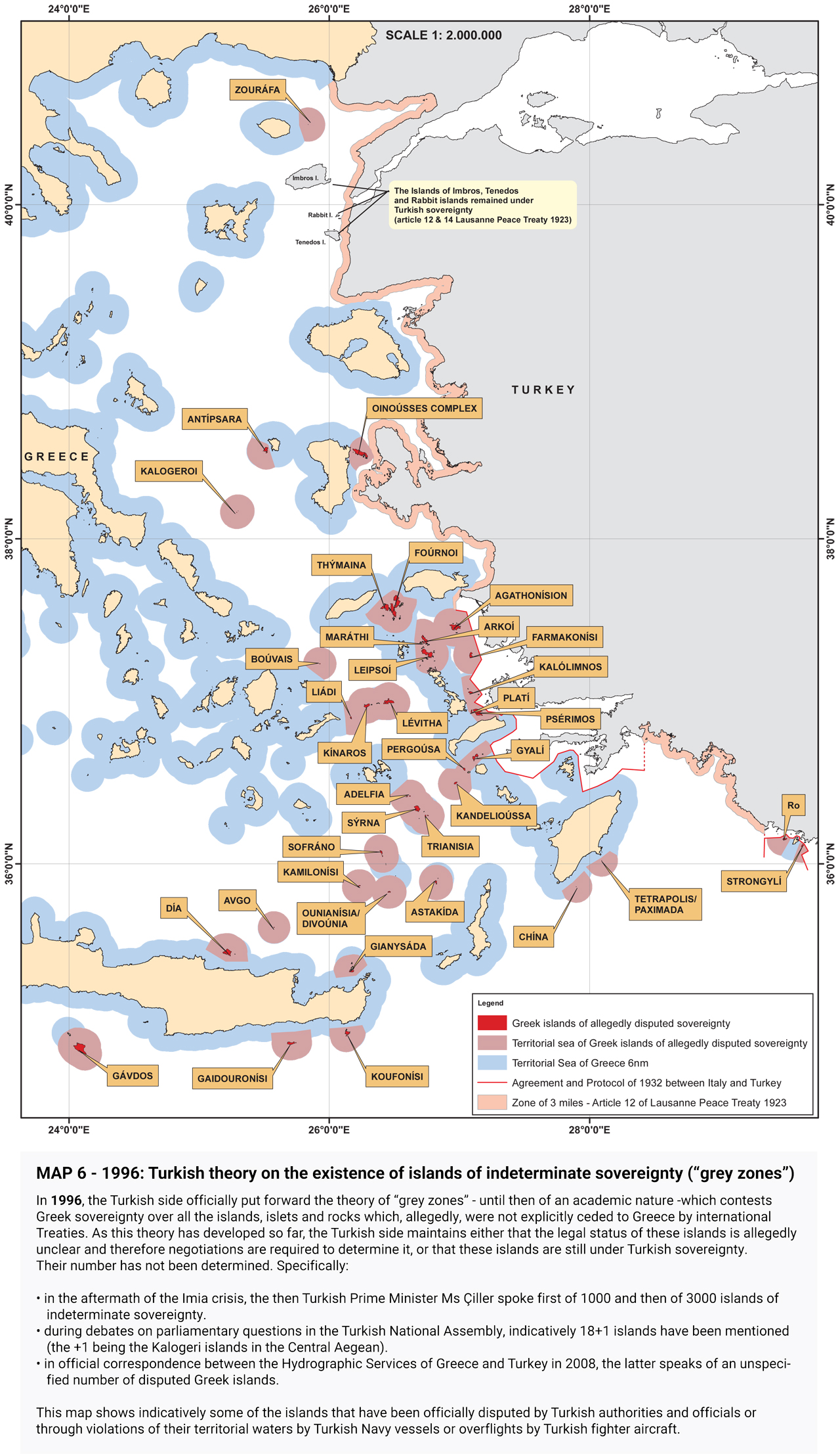
They go on to present Turkish claims, beginning with the illegal licensing of the Turkish state oil company (TPAO) for exploration of oil fields in areas of the Greek continental shelf in the North Aegean in 1973, and continuing with the attempt to usurp Greece’s responsibility for Search and Rescue services in half of the Aegean in the 1980s, the “grey zone” theory in the 1990s, further escalation with the granting of new licenses in the Eastern Mediterranean, the endorsement of the “Blue Homeland” as an official doctrine, the “Turkish-Libyan Memorandum,” reaching as far as the Turkish theory of the demilitarization status of the Aegean islands.
Source: ekathimerini.com
Here are the maps:
1923
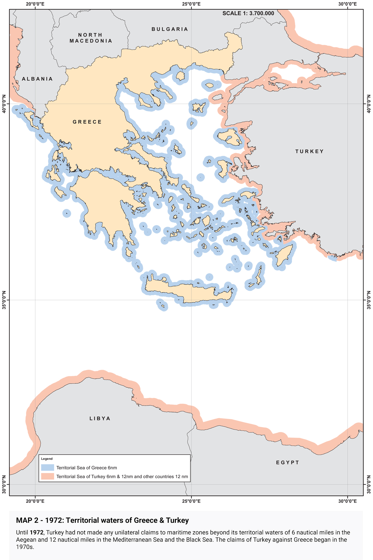
1972
1973
1974
Turkish Search and Rescue (SAR) Regulation
1996
2009, 2012: Publication of TPAO licenses
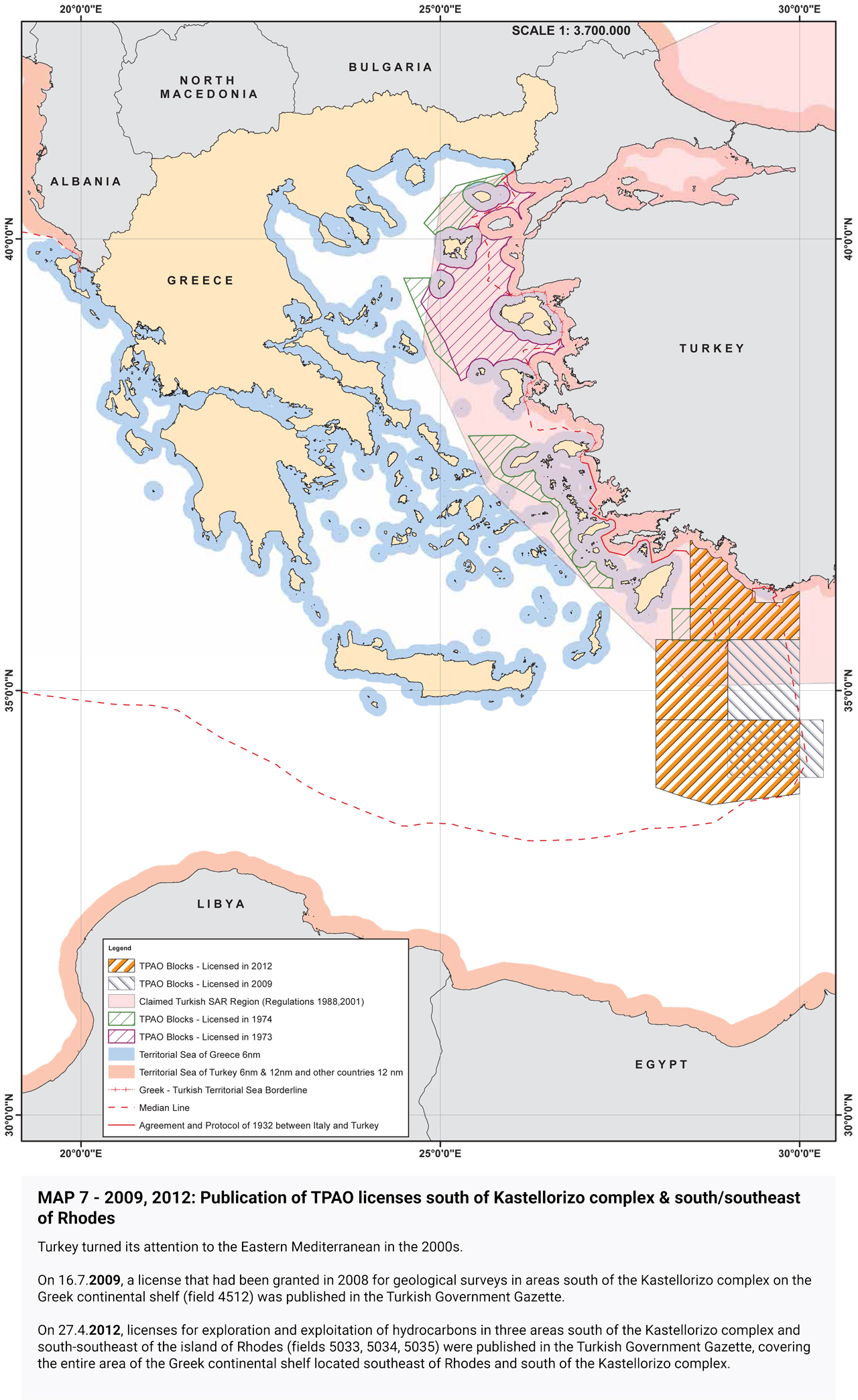
2019: The “Mavi Vatan” (Blue Homeland)
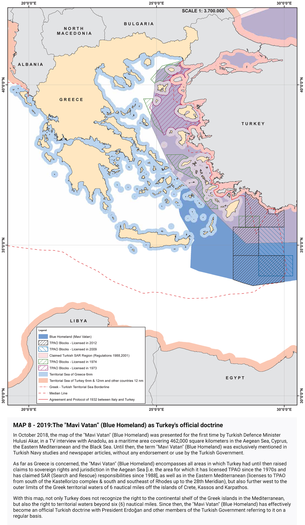
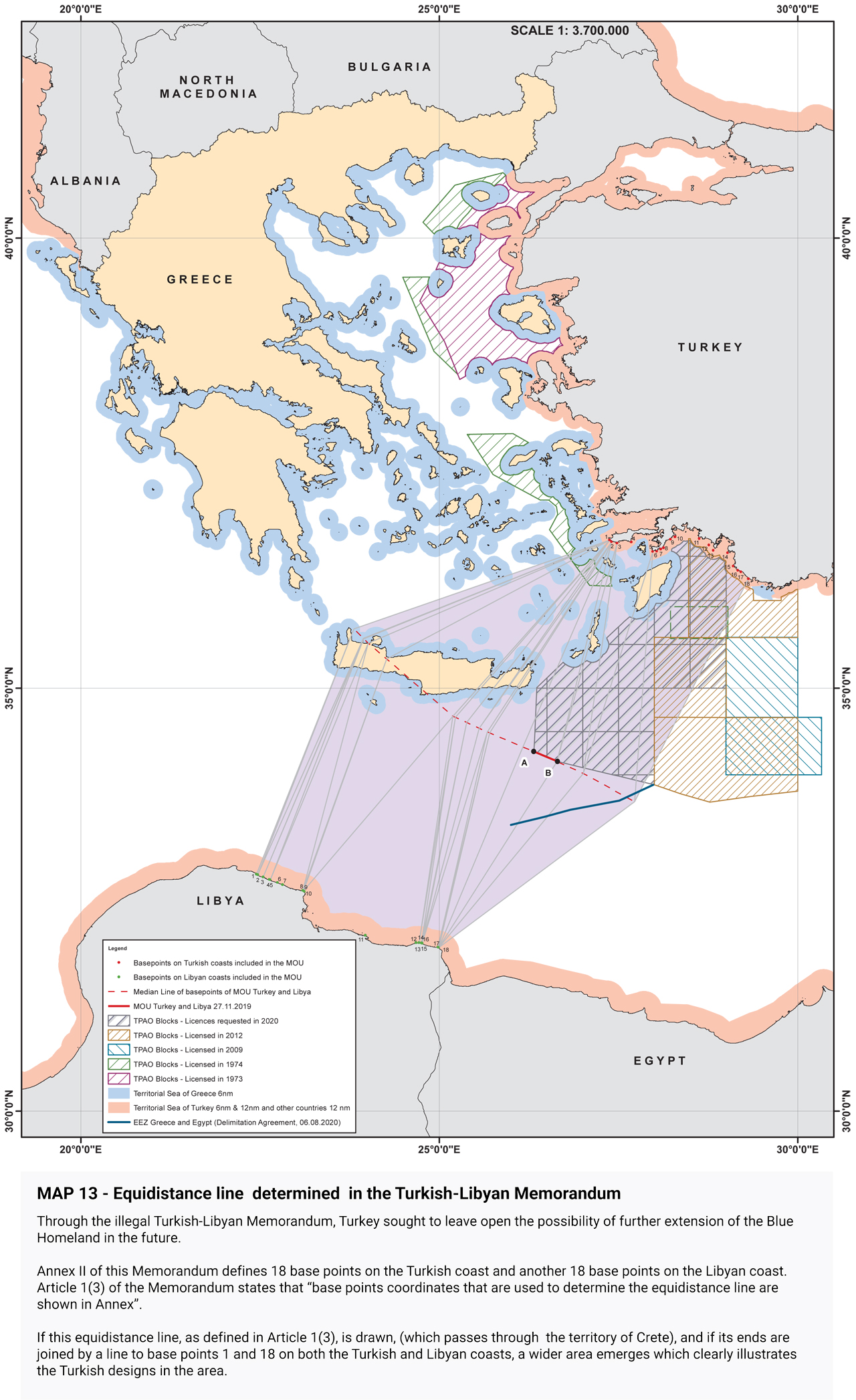
2019: Signing of the Turkish-Libyan Memorandum
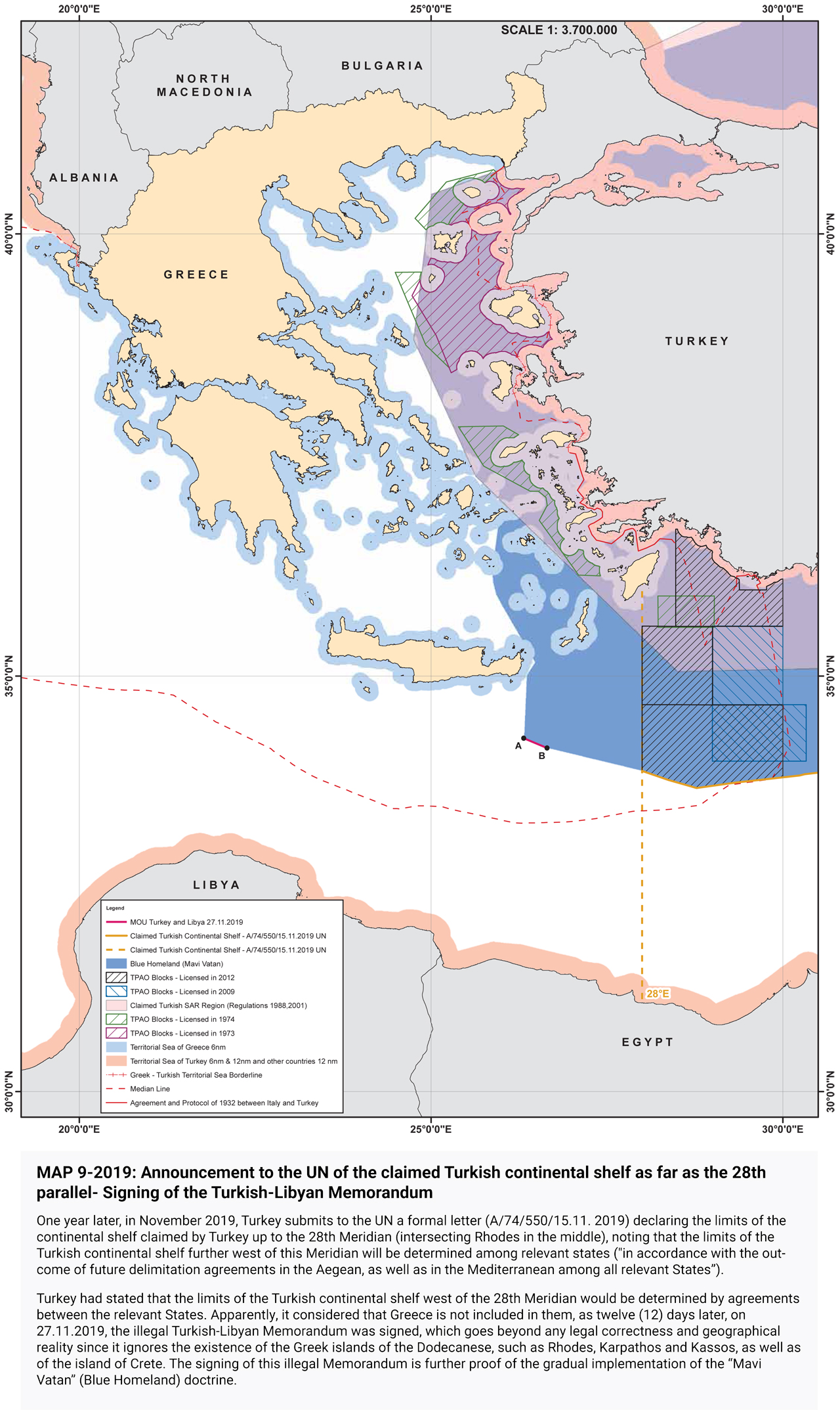
2020: The continental shelf claimed by Turkey
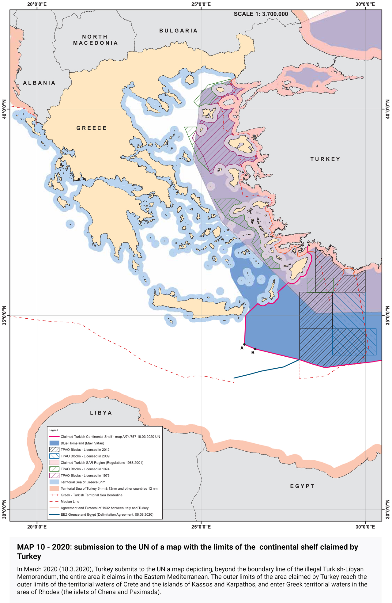
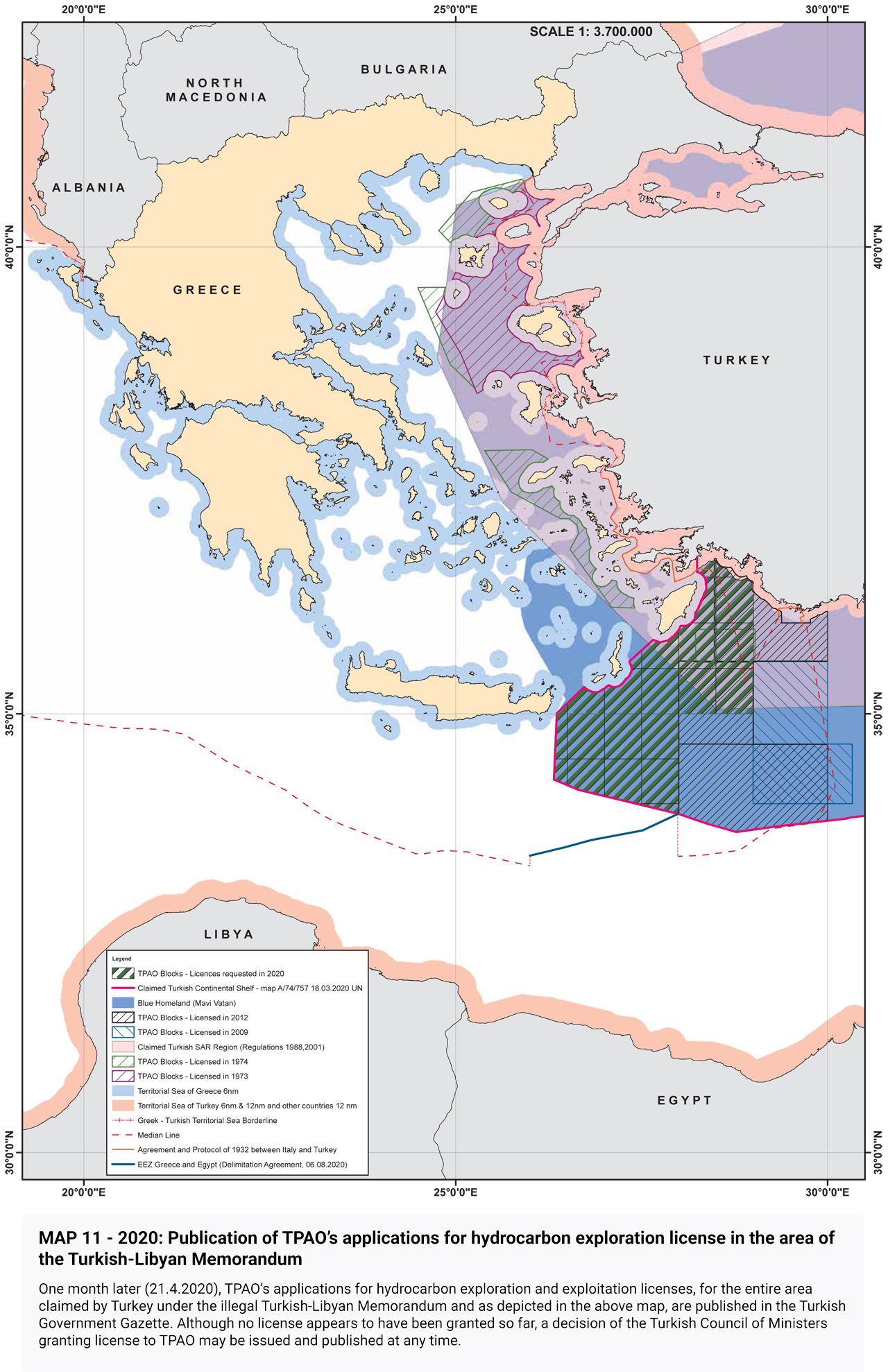
2020: TPAO’s applications for hydrocarbon exploration license in the area of
the Turkish-Libyan Memorandum
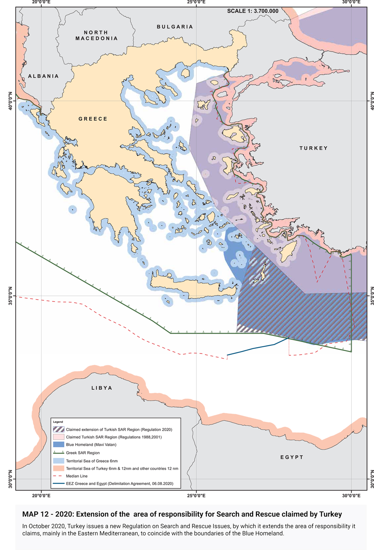
2020: Extension of the Search and Rescue area claimed by Turkey
Equidistance line determined in the Turkish-Libyan Memorandum
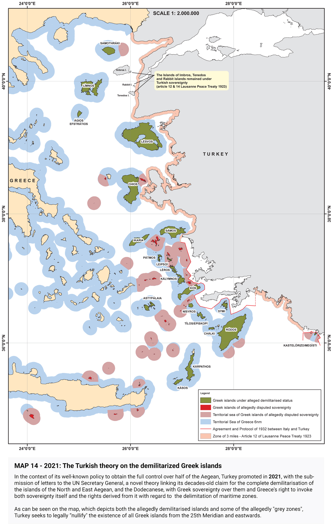
2021: The Turkish theory on the demilitarized Greek islands
Turkish claims today (2022)
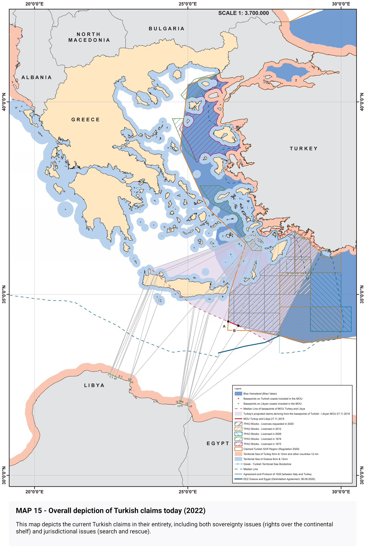
Comparative depiction of Turkish claims/designs 1972-2022
