First death reported from latest flooding in NSW as more residents asked to evacuate
A man has become the first fatality in the latest flood event in New South Wales as authorities urge people in at-risk communities to evacuate early.
Emergency services attempted to rescue the as yet unidentified man at Parramatta River, who was reportedly kayaking when he drowned.
Despite the efforts of the police and staff from marine rescue, the man died at the scene.
A member of the public also attempted to save the man. NSW Police said authorities are attempting to identify him. A report will be prepared for the coroner.
More evacuation orders were issued across NSW on Sunday as heavy rain is forecast to push river levels higher than those recorded during the flood events of the last two years.
Severe weather is predicted to continue for days, affecting areas stretching from Newcastle to the South Coast and as far inland as Oberon, including western Sydney’s flood-prone Hawkesbury-Nepean area.

Maojr flooding has resulted in road closures near the North Richmond Bridge and Yarramundi Bridge. Source: Facebook / Transport for NSW
The Bureau of Meteorology had a severe weather warning in place for heavy rain leading to flash flooding, winds up to 90km/h and damaging surf along the coast on Sunday afternoon.
The agency said the Hawkesbury River at North Richmond could reach 15 metres late on Sunday evening.
Warragamba Dam in Sydney’s west began overflowing at 2am, well ahead of predictions.
Saturated Sydney braces for further flooding as torrential rain continues
03 Jul 2022, 12:38 pm
Saturated Sydney braces for further flooding as torrential rain continues
WaterNSW said its modelling showed water spilling out of the dam at a rate of about 240 gigalitres a day, and coming into the dam at about 380GL a day, with both figures expected to rise as rain increased.
The agency’s modelling indicated the peak spill would be comparable to flooding in March of last year.
The Hawkesbury-Nepean River exceeded major flood levels on Saturday night and releases from the dam could contribute to further rises.
The bureau warned river heights could reach those of March this year at North Richmond and Windsor.
Residents told to evacuate early
Residents in a number of areas have been ordered to evacuate, but Emergency Services Minister Steph Cooke said people don’t need to wait to be told to leave.
“If you are feeling uncomfortable or unsure about your circumstances, and there is an opportunity for you to leave earlier, don’t necessarily wait for an evacuation order,” she said.
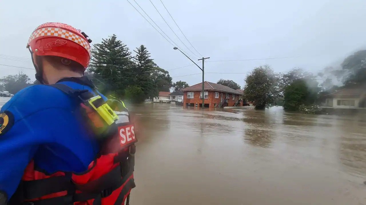
SES Commissioner Carlene York said the agency conducted 29 flood rescues in the past 24 hours.
The situation worsened so quickly overnight several areas were ordered to evacuate without the usual warning.
Ms York said locals should monitor the situation while also checking for SES warnings to evacuate.
“Be prepared and be aware of your surroundings so that you can make a sensible and safe decision,” she said.
Evacuation centres are active in western Sydney at Canley Vale’s Cabra-Vale Diggers Club, Narellan community centre, Gymea Tradies Club, Richmond Club, North Richmond community centre and Castle Hill RSL.

NSW SES workers rescue Shetland ponies at Milperra. Source: Facebook / NSW SES Bankstown Unit
Close to 300mm of rain recorded over 24 hours in parts of NSW
The SES was joined by 100 Australian Defence Force members on Sunday, assisting with sandbagging and doorknocking communities to warn of flood threats.
“At this stage, we’ve asked them to really concentrate on the Hawkesbury-Nepean Valley area which seems to be the big risk,” Ms York said.
The bureau’s hazards preparation and response manager Jane Golding said a coastal trough lingering since Friday deepened while an east coast low-pressure system formed off the Mid North Coast.
“That’s produced some extraordinary rainfall rates over the last 24 hours… many locations have seen up to 200mm and some close to 300mm,” she said.
The weather system is expected to move south along the Hunter, Central and Sydney coasts in the next 24 hours.
Thunderstorms are also expected, potentially delivering more rain and flash floods, Ms Golding said.
People are being told to avoid any non-essential travel, including on public transport, with some roads already underwater and others at risk of sudden flash flooding.
The latest NSW SES warnings can be found here.
Evacuation orders in place for:
Agnes Banks, Angus, Gronos Point, Plough and Harrow Dam near Abbotsbury and Cecil Hills, Pleasure Point, Bents Basin, Wallacia, Camden, Woronora, Chipping Norton, Georges Hall, Lansvale, Moorebank, Warwick Farm, Leets Vale, Ebenezer, Pitt Town, Pitt Town Bottoms, North Richmond, Sackville, Cattai, Cornwallis, Richmond Lowlands, South Windsor and Bligh Park.
Evacuation warnings affect:
East Hills, Picnic Point, Penrith, Emu Plains, Mulgoa, Jamisontown and Cranebrook.
Moderate to major flooding forecast for:
Hawkesbury and Nepean Rivers, Colo River, Georges River and Shoalhaven River.
Source: sbs.com.au