Scientists launch tool to detect bleaching of coral reefs in near real time

Scientists have launched a world-first system to detect in almost real time the bleaching of the planet’s coral reefs that are under severe threat from global heating.
The developers of the new tool, which has been four years in the making, claim it can allow anyone to check if reefs known to be under heat stress have actually started to bleach.
Coral reefs that support the livelihoods of hundreds of millions of people and are home to about a quarter of all ocean species are one of the ecosystems most threatened by global heating.
The United Nations’ climate assessment says coral reefs are projected to decline by between 70% and 90% even if global warming is kept to 1.5C.
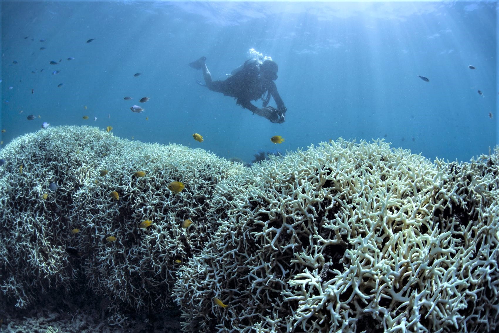
Mass bleaching events, which are becoming more frequent, can weaken corals or, in severe cases, kill them off over large areas.
The new tool, funded by Vulcan Inc, the company founded by the late Microsoft co-founder Paul Allen, could reveal the full extent of bleaching worldwide and also reveal spots where corals are surviving.
Currently, US government agency the National Oceanic and Atmospheric Administration makes predictions about the likelihood of bleaching across the world using models and sea surface temperature measurements from satellites.

Prof Greg Asner, the managing director of the Allen Coral Atlas that has launched the tool, said his team had developed and trialled it during two bleaching events – one severe outbreak in French Polynesia in early 2019 and another milder bleaching in Hawaii, where he is based, later the same year.
He said the team of developers – at Arizona State University, the University of Queensland, National Geographic Society, satellite company Planet, and Vulcan – had worked out how to overcome two big problems: clouds getting in the way of the satellite, and the way light shifts as it travels through water and the atmosphere.
The tool collects and combines images over six days, reducing the chances of clouds obscuring the satellite’s view.
Asner, of Arizona State University, wants the new tool to be used by governments and reef managers around the globe to help target conservation efforts.
Using two sets of satellite imagery – one from a constellation of small satellites and another from two larger satellites – the tool archives daily images of coral reefs mapped by the University of Queensland.
By comparing different sets of images of coral reefs before they bleach, the tool detects the dramatic colour changes that are characteristic of coral bleaching.
Bleaching is a stress reaction. If corals sit in unusually hot water for too long they separate from the colour-giving algae that provide most of their nutrients.
For now, Asner said the tool will refresh every two weeks and focus on areas NOAA’s Coral Reef Watch warns are under threat.
He said as well as being able to see where corals have bleached, the tool can also identify areas that don’t bleach – known as refugia.
“Knowing where these refugia are will be really important,” he said, adding that this could help governments identify where to carry out research or conservation efforts.
There are plans to further develop the Allen Coral Atlas to detect other threats to coral reefs from pollution running off from the land.
Asner added: “The science is showing us that areas [of coral reefs] that get a double-whammy of heat and pollution are doing much worse.”
Rapidly cutting greenhouse gas emissions was vital, Asner said, as there were still healthy coral reefs around the world that could be saved.
Reefs are monitored in several ways – from underwater surveys and citizen science efforts, to autonomous underwater gliders with onboard thermometers or monitoring flights in planes.
Dr Manuel Gonzalez Rivero, who leads the reef monitoring team at the Australian Institute of Marine Science, said the tool was a “significant step forward”.
“This is a resource that has never existed before. What this does is enable us to really understand how much the impact [of heat stress] translates across large areas.”
He said Aims – the Australian government’s marine science agency – had been working with the Allen Coral Atlas and would be using the new tool.
Current tools use meteorological forecasts and calculations of heat stress on corals to provide bleaching warnings.
“But that doesn’t give us a full picture. This to me is a significant step forward in where we are at the moment. Having information in real time can help us with our more reactive monitoring.”
The ability of corals to tolerate extra heat varies across species. There is evidence that the composition of corals on reefs has already shifted with less tolerant species becoming more scarce.
“This will document something that will paint a challenging picture of what’s happening and that will be hard. But the point is that understanding the onset of bleaching can help us be more proactive.”
The tool relies on detailed maps of more than 230,000 reefs and their surroundings covering about 140,000sq km developed at the University of Queensland’s Remote Sensing Research Centre. That mapping tells the tool where on the planet it should be looking for changes.
Dr Chris Roelfsema, from the research centre, said the maps covered about 82% of the world’s reefs.
He said: “Until now, there hasn’t been a global system in place to monitor coral reefs under the stresses that may lead to their deaths.”
Roelfsema’s team had already mapped the Great Barrier Reef when they were asked by Asner’s team about four years ago if they could cover the entire globe.
“It was an exciting question. These satellites – some are 700km above the earth – and the Planet satellites are only the size of a microwave.
“Five or 10 years ago we couldn’t have done this. The capability just wasn’t there.”
Source: The Guardian


