Australia: Eastern states brace for second day of heavy rain and floods


Australia’s east coast is bracing for another day of heavy rain, flooding, and gale force winds as a slow moving low-pressure system continues to roll across the nation.
Parts of southern Queensland, New South Wales and Victoria are on a high alert with flood and weather warnings already in place.
The weather system has left a trail of destruction in its wake, with Weatherzone yesterday detecting 1.37 million lightning pulses across central and eastern Australia.
A long line of thunderstorms formed stretching 2500 kilometres across the Northern Territory’s Top End and southeast Queensland, according to Weatherzone.
Up to 100mm of rain has been dumped across much of central and eastern Australia since Wednesday evening.
“Moderate to large totals” also fell in South Australia and Tasmania, meteorologist Jonathan How said.
In the outback Queensland town of Roma, residents were hit with torrential rain, hail and even cyclonic winds, forcing families to hide inside their homes.
One home had its roof torn off.
Rescue missions unfolded in northern NSW with four people having to be saved from floodwaters.
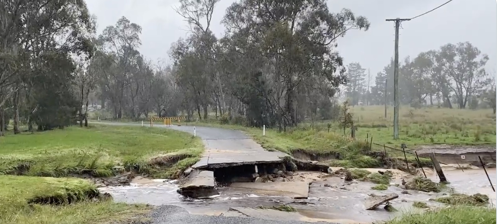
A road on the outskirts of Stanthorpe in Queensland completely washed away in one torrent, reminding motorists of the dangers of driving in floodwaters.
South Australia was also caught in the eye of the storm, with gale force winds of up to 70km/h lashing Adelaide.
The cyclonic winds blacked out Adelaide’s city causing major peak hour delays.
Southern parts of the Northern Territory and parts of the North West Pastoral Districts, West Coast, Flinders Ranges and Eastern Eyre Peninsula in South Australia are also on flood watch.
Wild weather to continue
Flood warnings are still in place across Queensland, NSW, with drivers urged to take care on the roads.
The Bureau of Meteorology (BoM) has issued a moderate flood warning for the Macintyre River, which winds through both Queensland and NSW.
Several minor flood warnings are also in effect for the Queensland’s south.
In NSW a severe thunderstorm warning has been issued for parts of Central Tablelands, Southern Tablelands, Central West Slopes and Plains, South West Slopes and Riverina Forecast Districts.
“Severe thunderstorms are likely to produce damaging winds and heavy rainfall that may lead to flash flooding in the warning area over the next several hours,” the Bureau of Meteorology (BoM) wrote.
Locations which may be affected include Orange, Goulburn, Yass, Parkes, Wagga Wagga and Griffith.
Victoria, which has so far been spared much of the destruction, is today expected to be hit with flash flooding and strong winds.
Storm warnings are in place for the Central and North Central Forecast District and East Gippsland, West and South Gippsland and parts of North East Forecast Districts.
The BoM warned peak gusts of around 90 km/h are possible, before easing by Friday evening.
Winds are expected to average 55 to 70 km/h.
Rainfalls of 25-50 mm are likely across the warning area, with some falls of 50-80 mm possible across the Gippsland, it said.
Source: 9news.com.au


