Australia: BOM declares La Nina event as east coast braces for rains, floods and cyclones
Australia will experience a La Nina weather pattern that will increase the risk of widespread flooding and severe tropical cyclones this summer.
The Bureau of Meteorology has predicted Australia may have experienced its coldest spring since 1999, with low temperatures set to continue into the warmer months.
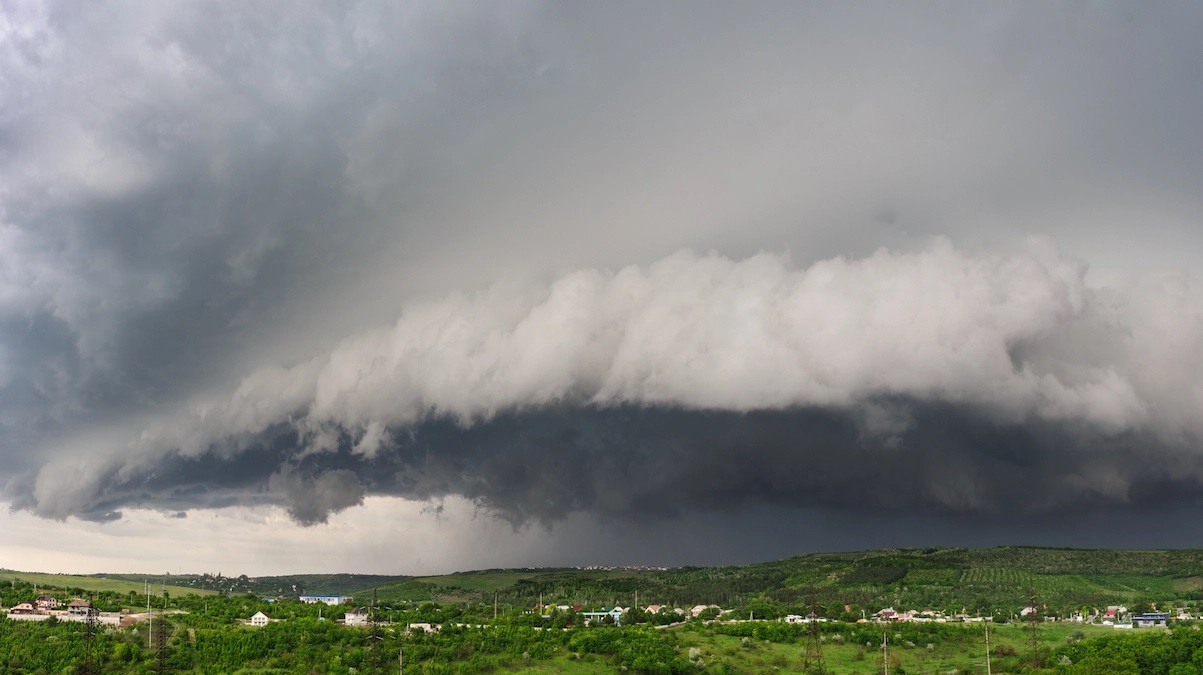
Parts of NSW are already experiencing heavy rains and floods, while the first tropical cyclone of the 2021-22 season is strengthening off the coast of Western Australia, 400 kilometres south-east of Christmas Island.
The bureau’s head of operational climate services Andrew Watkins said the La Nina alert had been issued in November, meaning there was a 70 per cent chance of an event developing, but the outlook was upgraded on Tuesday.
The La Nina is likely to last until at least January. Dr Watkins said the increased rainfall would heighten the chance of flooding, with soils saturated and rivers and catchments full.
“It does mean we get cooler temperatures for Australia, particularly in the eastern and the southern parts,” he said. “We can still get heatwaves, the heatwaves we can get over summer tend to be longer … and more humid. In terms of tropical cyclones, we do tend to see more than average. We’ve got about a 65 per cent chance of seeing more than our average number of 11 cyclones.”
Despite the cooler conditions, the threat of grass fires remains, as the rain had encouraged strong vegetation growth.
“We have seen a relatively wet spring and wet November, it could be our coolest spring since 1999 and our wettest spring since 2011,” Dr Watkins said.
This year’s La Nina is set to be weaker than the 2010-12 weather pattern, which saw floods devastate large parts of Queensland and NSW. During that time, three-quarters of Queensland flooded and 35 people died. At least 70 towns and communities and 2.5 million people were affected, including large parts of Brisbane, creating an estimated damage bill of $5 billion.
Despite the weaker conditions this time, Dr Watkins said parts of the country would see heavy rainfall and floods.
In the coming days, some parts of NSW, Queensland and Victoria are likely to see between 50 and 100 mm of rain and severe thunderstorms, which will place pressure on already-brimming waterways.
The bureau’s senior meteorologist, Dean Narramore, said residents on any rivers in NSW and Queensland needed to remain on high alert for flooding on Thursday and Friday.
“On Friday, the focus of the rain and thunderstorm activity will move to eastern parts of Queensland, NSW and down into eastern Victoria where we could see, again, widespread heavy rainfall and severe thunderstorms,” he said. “This will, again, exceed the flooding impact increase across eastern parts of Victoria, NSW and Queensland.”
What does La Nina mean?
A La Nina phase is caused by stronger trade winds changing ocean surface currents, which draws cooler water from below. The winds also help pile up warm surface waters in the Pacific Ocean, meaning the area becomes more conducive to above-average clouds and rainfall across Australia, and a more active than normal tropical cyclone season (which can also bring rain far inland or down the eastern coast).
A La Nina can linger for two years. Weatherzone senior forecaster Ben Domensino said the last significant consecutive La Nina events occurred in 2010-2012 and 2007-2009.
“Last summer we had a La Nina-like pattern pretty well established, so it was only a matter of time before it was officially declared,” he said.
He added that other climate drivers, including a strong polar vortex over Antarctica earlier this year and a negative Indian Ocean dipole, were worsening wet weather conditions over eastern Australia.
The six wettest winter-spring periods on record for eastern Australia occurred during La Nina years. Across eastern Australia, the average December-March rainfall during La Nina years is 20 per cent higher than the long-term average.
The presence of La Nina also increases the chance of widespread flooding. Of the 18 La Nina events since 1900, 12 have resulted in floods across Australia. Parts of the country are likely to see an increase in tropical cyclones
University of NSW’s Climate Change Research Centre Associate Professor Andréa Taschetto said as climate change continues to alter the landscape, extreme La Nina and El Nino events are likely to become more common.
“In the future, we have more chances of storms, extreme rainfall and flood events,” she said. “It’s happening. We know global warming increases the chance of extreme events: bushfires, temperatures and droughts.”
Source: smh.com.au